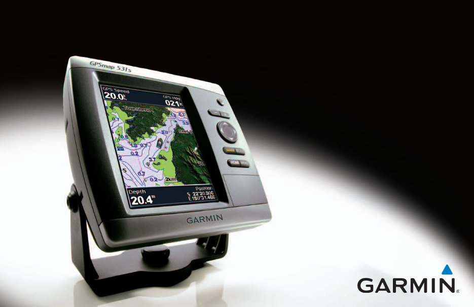
GPSMAP 400/500 Series Owner’s Manual i Introduction Introduction This manual includes information for the following products: GPSMAP ® 430/430s GPSMAP 440/440s GPSMAP 431/431s GPSMAP 441/441s GPSMAP 530/530s GPSMAP 535/535s GPSMAP 531/531s GPSMAP 536/536s GPSMAP 540/540s GPSMAP 545/545s GPSMAP 541/541s GPSMAP 546/546s Tips and Shortcuts • Press HOME from any screen to return to the Home screen. • Press MENU from any of the main screens to access advanced settings. • Press and release the Power key to adjust the display settings. Manual Conventions In this manual, when you are instructed to select an item, small arrows (>) appear in the text. They indicate that you should highlight a series of items on the screen using the Rocker, and press the SELECT key after each item. For example, if you see “select Charts > Navigation Chart,” you should highlight Charts, and press SELECT. Then highlight Navigation Chart, and press SELECT again. Quick Links • Turning the Unit On or Off: page 3. • Acquiring GPS Satellite Signals: page 5. • Inserting and Removing SD Cards: page 6. • Restoring Factory Settings: page 6. • Using the Navigation Chart: page 8. • Changing the Chart Settings: page 12. • Navigating to a Destination: page 27 • Creating and Using Waypoints: page 29. • Configuring System Settings: page 41. • Using Sonar: page 50. • Alarms and Messages: page 71.
ii GPSMAP 400/500 Series Owner’s Manual Introduction Table of Contents Introduction...........................................................................i Tips and Shortcuts ........................................................................ i Manual Conventions ..................................................................... i Quick Links ................................................................................... i Declaration of Conformity (DoC) ..................................................iv Product Registration ....................................................................iv Contact Garmin ............................................................................iv Getting Started.....................................................................1 Unit Overview............................................................................... 1 Turning the Unit On or Off ............................................................ 3 Initializing Unit Settings ................................................................ 3 Adjusting the Backlight................................................................. 4 Using the Keypad......................................................................... 5 Acquiring GPS Satellite Signals ................................................... 5 Using Simulator Mode.................................................................. 6 Viewing System Information ........................................................ 6 Restoring the Original Factory Settings ....................................... 6 Inserting and Removing SD Cards .............................................. 6 Understanding the Home Screen................................................. 7 Using Charts ........................................................................8 Using the Navigation Chart .......................................................... 8 Changing the Navigation Chart Settings .................................... 12 Using the Split Navigation Chart ................................................ 15 Using Perspective 3D ................................................................ 15 Using Mariner’s Eye 3D ............................................................. 16 Using Fish Eye 3D ..................................................................... 18 Using Fishing Charts.................................................................. 19 Enabling High Resolution Satellite Imagery ............................... 19 Viewing Aerial Photos ................................................................ 20 Viewing Current-station Information........................................... 21 Detailed Road and POI Data ..................................................... 21 Using Automatic Guidance......................................................... 21 Using the Chart/Sonar Screen ................................................... 21 Automatic Identification System ................................................. 22 Where To? ..........................................................................27 Navigating to a Destination ........................................................ 27 Creating and Using Waypoints................................................... 29 Creating and Using Routes ........................................................ 30 Using Tracks .............................................................................. 31 Using BlueChart g2 Vision ......................................................... 33 Navigating with a Garmin Autopilot ............................................ 33 Viewing Information ..........................................................34 Viewing a Compass ................................................................... 34 Viewing Numbers ....................................................................... 34 Viewing Trip Information ............................................................ 35 Viewing Fuel Gauges ................................................................. 35 Viewing Tide-station Information ................................................ 36 Viewing Current Information ...................................................... 36 Viewing User Data ..................................................................... 37 Viewing Other Vessels ............................................................... 40
GPSMAP 400/500 Series Owner’s Manual iii Introduction Configuring the Chartplotter ............................................41 Configuring System Settings...................................................... 41 Configuring Units of Measure .................................................... 41 Changing the System Language................................................ 42 Configuring Navigation Preferences .......................................... 42 Configuring Communications Settings ....................................... 44 Setting Alarms ............................................................................ 45 Setting the Total Fuel Onboard Alarm ........................................ 47 Configuring My Boat .................................................................. 47 Configuring Other Vessels ......................................................... 48 Using Sonar .......................................................................50 Understanding the Full Screen .................................................. 50 Understanding the Split Frequency Screen ............................... 51 Understanding the Split Zoom Screen ....................................... 51 Understanding the Temp Log Screen ........................................ 52 Setting Up Sonar........................................................................ 52 Advanced Sonar Settings .......................................................... 53 Using Digital Selective Calling (DSC) ..............................55 Using the Chartplotter with a VHF Radio ................................... 55 Adding a DSC Contact ............................................................... 56 Viewing the DSC List ................................................................. 56 Receiving Distress Calls ............................................................ 56 Man-Overboard Distress Calls Initiated from a VHF Radio ....... 57 Man-Overboard Distress Calls Initiated from the Chartplotter ... 57 Position Tracking........................................................................ 57 Placing an Individual Routine Call ............................................. 58 Calling an AIS Target ................................................................. 59 Using XM WX Weather and Audio ....................................60 Using XM WX Weather .............................................................. 60 Viewing NEXRAD Precipitation Information............................... 61 Viewing Forecast Information .................................................... 64 Viewing Fishing Information ....................................................... 65 Viewing Sea Conditions ............................................................. 66 Viewing Visibility Information...................................................... 67 Using XM Audio ......................................................................... 68 Appendix ............................................................................69 Specifications ............................................................................. 69 Alarms and Messages ............................................................... 71 Capturing Screenshots .............................................................. 74 Caring for the Unit ...................................................................... 74 Weather Data Warranty ............................................................. 75 Software License Agreement ..................................................... 76 XM Satellite Radio Service Agreement ...................................... 76 Index ...................................................................................77
iv GPSMAP 400/500 Series Owner’s Manual Introduction See the Important Safety and Product Information guide in the product box for product warnings and other important information. Hg - LaMPS iNSidE THiS PROdUCT CONTaiN MERCURy aNd MUST bE RECyCLEd OR diSPOSEd Of aCCORdiNg TO LOCaL, STaTE, OR fEdERaL LawS. For more information go to: www.garmin.com/aboutGarmin/environment/disposal.jsp. Declaration of Conformity (DoC) Hereby, Garmin, declares that the GPSMAP 400 series and the GPSMAP 500 series is in compliance with the essential requirements and other relevant provisions of Directive 1999/5/EC. To view the full Declaration of Conformity, see the Garmin Web site for your Garmin product: www.garmin.com. Product Registration Help us better support you by completing our online registration today. Go to http://my.garmin.com. Keep the original sales receipt, or a photocopy, in a safe place. Contact Garmin Contact Garmin Product Support if you have any questions while using your unit. In the USA, go to www.garmin.com/support, or contact Garmin USA by phone at (913) 397.8200 or (800) 800.1020. In the UK, contact Garmin (Europe) Ltd. by phone at 0808 2380000. In Europe, go to www.garmin.com/support and click Contact Support for in-country support information, or contact Garmin (Europe) Ltd. by phone at +44 (0) 870.8501241.
GPSMAP 400/500 Series Owner’s Manual 1 Getting Started Getting Started Unit Overview GPSMAP 536/546 POWER/ BACKLIGHT MENU ROCKER SELECT HOME RANGE (-/+) MARK SD card slot Power/Data GPSMAP 546 shown External GPS antenna NMEA 2000 GPSMAP 531
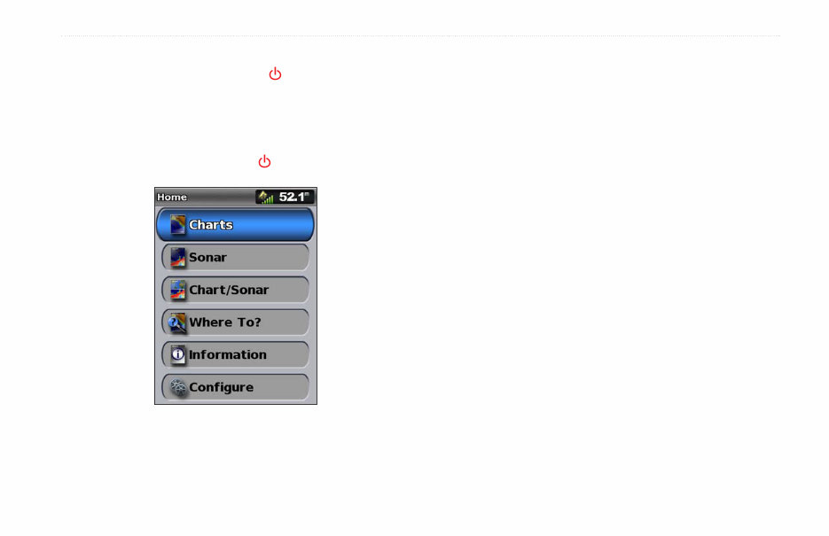
GPSMAP 400/500 Series Owner’s Manual 3 Getting Started Turning the Unit On or Off To turn on the unit, press and release the Power key. When the Warning screen appears, select i agree to view the Home screen. NOTE: The first time you turn on your unit, you must configure the initial settings. See “Initializing Unit Settings.” To turn off the unit, press and hold the Power key. Home Screen Initializing Unit Settings The first time you turn on your unit, you must configure the initial settings. NOTE: You can change these settings later using the Configure screen (page 6). Language—select the language to display on your screen. welcome—select OK. Store demonstration—select NO. (This option is only available the first time the unit is turned on.) NMEa 0183 devices—if you have NMEA 0183 devices connected to a serial port, specify which ports are connected. aiS Receiver (is not available if you select None for NMEa devices)—Select yes if one of the devices connected to a serial port is an AIS (automatic identification system) receiver. Position format—specify the coordinate system to use for location readings. Time format—specify whether you want the time shown in a 12-hour, 24-hour, or UTC (Universal Time Coordinated) format. System Units—specify units for on-screen measurements as Statute, Metric, or Nautical.
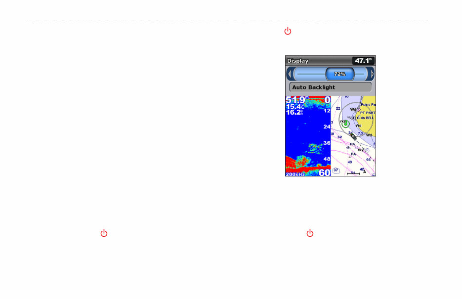
4 GPSMAP 400/500 Series Owner’s Manual Getting Started Minimum Safe depth—select the minimum safe depth for your boat. Refer to your boat specifications for more information. Shallow water alarm—only available if you are receiving NMEA sonar depth data. Select yes or No. Minimum Overhead Clearance—select the minimum overhead clearance for your boat. Refer to your boat specifications for more information. aiS alarm Range (is not available if you select No for aiS Receiver)—select the distance within which an alarm will sound if an AIS vessel nears your boat (page 49). aiS alarm Time To (is not available if you select No for aiS Receiver)—select the time within which an alarm will sound if an AIS vessel is on track to intersect the Safe Zone around your boat (page 49). If a water speed wheel is detected, a message will ask if you want to calibrate it now. Select yes or No. Adjusting the Backlight 1. Press and release the Power key. 2. Select Backlight. 3. Press left or right on the Rocker to manually adjust the backlight. NOTE: Press the Power key repeatedly to cycle between maximum backlight, minimum backlight, and your manual setting. To allow the unit to automatically adjust the backlight based on ambient light, select auto backlight (automatic backlight is available only on the GPSMAP 535, 536, 545, and 546). To switch between Day mode and Night mode: 1. Press and release the Power key. 2. Select Color Mode. 3. Press left or right on the Rocker to switch between modes.
The Garmin GPSMAP 400/500 Series Owner User Manual is a comprehensive guide designed to assist both professional mechanics and DIY enthusiasts in understanding and maintaining their GPSMAP 400/500 Series devices. This manual provides detailed information on the features, functions, and operation of the GPSMAP 400/500 Series, making it an invaluable resource for troubleshooting and repairs.
Whether you are a seasoned mechanic or a passionate DIY enthusiast, this manual offers step-by-step instructions and diagrams to help you navigate through the intricacies of the GPSMAP 400/500 Series. With its clear and concise language, this manual is an essential tool for anyone looking to optimize the performance and longevity of their GPSMAP 400/500 Series device.